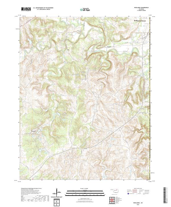
2022 Map of Woolaroc
USGS Topo · Published 2022About this map
The Woolaroc ranch and preserve area occupies a significant portion of this terrain in western Osage Co, where the landscape is defined by the headwaters of several drainages. Numerous natural water sources, including Ponce De Leon Spring and Nehawaski Spring, are recorded alongside impoundments like Crystal Lake and Lake Higo. This topography of the Osage Hills transitions from the high ground at Buck Point down through Whisky Hollow toward the northeastern corner of the map, where the city of Bartlesville begins to emerge.
Find a feature on this map
106 named features on this map. Tap any name to fly to it.
Don’t see what you’re looking for? This feature index may not catch every label — zoom into the map to look around manually.
Map Details
Editions of this 2022 Woolaroc Map
This is the sole edition of this map. No revisions or reprints were ever made.
Other maps of this area

1901 · Nowata
USGS Topo · 1:125,000

1906 · Nelagoney
USGS Topo · 1:24,000

1909 · Pawhuska
USGS Topo · 1:125,000

1910 · Pawhuska
USGS Topo · 1:125,000

1914 · Nowata
USGS Topo · 1:125,000

1954 · Tulsa
USGS Topo · 1:250,000

1955 · Enid
USGS Topo · 1:250,000

1958 · Enid
USGS Topo · 1:250,000

1958 · Tulsa
USGS Topo · 1:250,000

1960 · Nelagoney
USGS Topo · 1:24,000