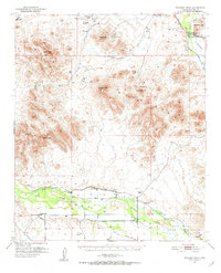
1951 Map of Woolsey Peak
USGS Topo · Published 1952About this map
Woolsey Peak dominates the center of this 1951 survey, surrounded by the high desert peaks of the Gila Bend Mountains. To the north, the small settlement of Arlington sits near Arlington Valley, while the Gila River flows through the southern and eastern corridors. This landscape is a hybrid of ancient history and early mid-century resource extraction, where Petroglyphs and Indian Ruins on the Gila Bend Indian Reservation coexist with the Harcan Mine and Buckeye Copper Mine. The irrigation infrastructure of the Citrus Valley is clearly visible, including the Enterprise Canal and the now-defunct Citrus Ditch (Aban'd). Researchers will find a network of water-dependent features such as Moody Spring, Webb Well, and various windmills that supported ranching operations at sites like Warford Ranch. The presence of multiple landing strips and a Pipe Line suggests the increasing industrialization and aerial surveying common in Arizona during the post-war era.
Find a feature on this map
35 named features on this map. Tap any name to fly to it.
Don’t see what you’re looking for? This feature index may not catch every label — zoom into the map to look around manually.
Map Details
Editions of this 1951 Woolsey Peak Map
3 editions found
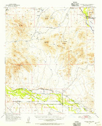
Other maps of this area

1942 · Vicksburg
USGS Topo · 1:250,000

1949 · Sentinel
USGS Topo · 1:62,500

1950 · Sentinel
USGS Topo · 1:62,500

1950 · Theba
USGS Topo · 1:62,500

1951 · Gila Bend
USGS Topo · 1:62,500

1951 · Theba
USGS Topo · 1:62,500

1951 · Dendora Valley
USGS Topo · 1:62,500

1951 · Cotton Center
USGS Topo · 1:62,500

1951 · Woolsey Peak
USGS Topo · 1:62,500

1953 · Ajo
USGS Topo · 1:250,000