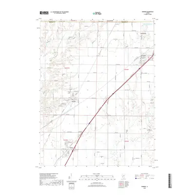
2018 Map of Worden
USGS Topo · Published 2018About this map
Worden and Livingston anchor this section of the Illinois prairie along the Madison and Macoupin county line. The landscape is a study in agricultural patterns and late-industrial water management, most notably seen at the Mount Olive Staunton Coal Company Reservoir in the northeast. Small-town development follows the path of major transit corridors, connecting Hamel and Williamson through a network of rural routes like Wieseman Rd and Renken Rd. Family and community history is preserved in numerous small burial grounds scattered across the townships, from the Hoxsey Family Cem to the Gehlenbeck Lutheran Cem. The terrain is carved by the winding paths of Cahokia Cr and Silver Cr, which provide a natural contrast to the rigid geometry of the surrounding farmsteads and the residential clusters of Meadow View Gardens.
Find a feature on this map
110 named features on this map. Tap any name to fly to it.
Don’t see what you’re looking for? This feature index may not catch every label — zoom into the map to look around manually.
Map Details
Editions of this 2018 Worden Map
This is the sole edition of this map. No revisions or reprints were ever made.
Other maps of this area

1912 · Gillespie
USGS Topo · 1:62,500

1915 · Gillespie
USGS Topo · 1:62,500

1915 · Mount Olive
USGS Topo · 1:62,500

1927 · Edwardsville
USGS Topo · 1:62,500

1932 · Edwardsville
USGS Topo · 1:62,500

1937 · New Douglas
USGS Topo · 1:48,000

1944 · New Douglas
USGS Topo · 1:62,500

1944 · Mount Olive
USGS Topo · 1:62,500

1950 · Edwardsville
USGS Topo · 1:24,000
1954 · Marine
USGS Topo · 1:24,000