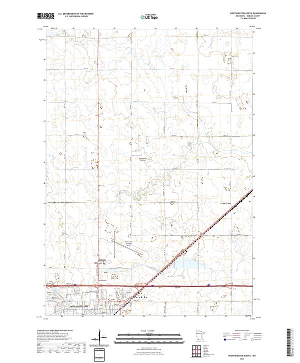
2022 Map of Worthington North
USGS Topo · Published 2022About this map
Worthington serves as the focal point for this 2022 survey of southwestern Minnesota, where the urban grid meets the agricultural expanse of the Coteau des Prairies. The northern expansion of the city is evident, with industrial and municipal infrastructure such as the Nobles County Justice Center and Industrial Ln defining the modern landscape. The Worthington Municipal Airport sits as a significant landmark north of the city center, positioned between the primary residential areas and the open township lands. The natural drainage of the region is traced by Elk Cr and Okabena Cr, which meander through the prairie landscape. A dense network of section-line roads, including 170th St and 250th St, illustrates the enduring influence of the Public Land Survey System on regional development and transport patterns.
Find a feature on this map
51 named features on this map. Tap any name to fly to it.
Don’t see what you’re looking for? This feature index may not catch every label — zoom into the map to look around manually.
Map Details
Editions of this 2022 Worthington North Map
This is the sole edition of this map. No revisions or reprints were ever made.
Other maps of this area

1954 · Fairmont
USGS Topo · 1:250,000

1958 · Fairmont
USGS Topo · 1:250,000

1960 · Brewster
USGS Topo · 1:24,000

1960 · Reading
USGS Topo · 1:24,000

1960 · Bigelow
USGS Topo · 1:24,000

1960 · Worthington North
USGS Topo · 1:24,000

1960 · Worthington South
USGS Topo · 1:24,000

1960 · Round Lake
USGS Topo · 1:24,000

1970 · Dundee
USGS Topo · 1:24,000

1970 · Fulda
USGS Topo · 1:24,000