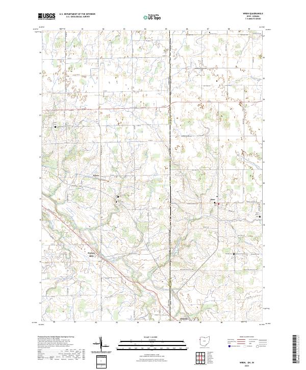
2023 Map of Wren
USGS Topo · Published 2023About this map
The Saint Marys River winds through this borderland landscape, crossing between Adams County, Indiana and Van Wert County, Ohio. The drainage network is dense with tributaries like Blue Creek, Martz Creek, and Yellow Creek, alongside constructed waterways such as Bowen Ditch. Small communities and agricultural junctions anchor the region, including Rivare, Pleasant Mills, Wren, and Willshire.
Find a feature on this map
71 named features on this map. Tap any name to fly to it.
Don’t see what you’re looking for? This feature index may not catch every label — zoom into the map to look around manually.
Map Details
Editions of this 2023 Wren Map
This is the sole edition of this map. No revisions or reprints were ever made.
Other maps of this area

1911 · Berne
USGS Topo · 1:48,000

1914 · Celina
USGS Topo · 1:62,500

1914 · Van Wert
USGS Topo · 1:62,500

1944 · Van Wert
USGS Topo · 1:62,500

1944 · Celina
USGS Topo · 1:62,500

1953 · Muncie
USGS Topo · 1:250,000

1956 · Muncie
USGS Topo · 1:250,000
1960 · Convoy
USGS Topo · 1:24,000

1960 · Dixon
USGS Topo · 1:24,000
1960 · Rockford
USGS Topo · 1:24,000