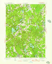
1946 Map of Wrentham
USGS Topo · Published 1946About this map
The town of Norfolk and the surrounding Norfolk and Bristol County borderlands are characterized by a landscape of institutional facilities and water-driven geography. In this mid-1940s survey, large-scale properties such as the State Prison Colony, Pondville Hospital, and a State Hospital appear as prominent features, reflecting the era's regional concentration of healthcare and correctional facilities. The New York New Haven and Hartford RR provides the primary industrial artery, cutting through settlements like City Mills, Wrentham, and Plainville.
Find a feature on this map
99 named features on this map. Tap any name to fly to it.
Don’t see what you’re looking for? This feature index may not catch every label — zoom into the map to look around manually.
Map Details
Editions of this 1946 Wrentham Map
2 editions found
Other maps of this area

1885 · Taunton
USGS Topo · 1:62,500

1886 · Dedham
USGS Topo · 1:62,500

1887 · Franklin
USGS Topo · 1:62,500

1887 · Providence
USGS Topo · 1:62,500

1888 · Taunton
USGS Topo · 1:62,500

1889 · Providence
USGS Topo · 1:62,500

1889 · Franklin
USGS Topo · 1:62,500

1893 · Taunton
USGS Topo · 1:62,500

1893 · Franklin
USGS Topo · 1:62,500

1894 · Dedham
USGS Topo · 1:62,500