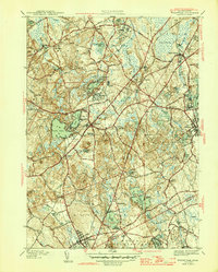
1946 Map of Wrentham
USGS Topo · Published 1946About this map
The New York New Haven and Hartford railroad cuts a definitive line through the Norfolk and Bristol County borderlands, connecting established industrial and residential centers just after the war. This 1946 edition reveals a landscape deeply influenced by institutional architecture, notably the State Prison Colony and the nearby State Hospital, which served as major landmarks and employers for the region. The map captures the intersection of small-town life and state-level infrastructure, with community clusters like Wampum Corner and Shepardville existing alongside larger facilities like the Pondville Hospital. The terrain is defined by its extensive wetlands and water bodies, from the sprawling Cedar Swamp to the recreational waters of Lake Pearl, illustrating the complex hydrology that historically powered local mills at City Mills. This survey serves as a vital record of the area's mid-century development before the massive expansion of the modern interstate system.
Find a feature on this map
70 named features on this map. Tap any name to fly to it.
Don’t see what you’re looking for? This feature index may not catch every label — zoom into the map to look around manually.
Map Details
Editions of this 1946 Wrentham Map
2 editions found
Other maps of this area

1885 · Taunton
USGS Topo · 1:62,500

1886 · Dedham
USGS Topo · 1:62,500

1887 · Franklin
USGS Topo · 1:62,500

1887 · Providence
USGS Topo · 1:62,500

1888 · Taunton
USGS Topo · 1:62,500

1889 · Providence
USGS Topo · 1:62,500

1889 · Franklin
USGS Topo · 1:62,500

1893 · Taunton
USGS Topo · 1:62,500

1893 · Franklin
USGS Topo · 1:62,500

1894 · Dedham
USGS Topo · 1:62,500