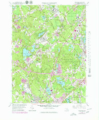
1964 Map of Wrentham
USGS Topo · Published 1979About this map
Institutional and medical landscapes dominate this mid-century view of Norfolk County, characterized by the expansive grounds of the Wrentham State School, Pondville State Hospital, and Foxborough State Hospital. These large campuses, along with the State Prison Reservation and the Massachusetts Correctional Institute of Walpole, represent a specific era of social infrastructure that shaped the regional geography. The map reveals a transition toward modern connectivity as purple revisions overlay the 1964 survey, highlighting the development of the interstate system through Wrentham.
Find a feature on this map
111 named features on this map. Tap any name to fly to it.
Don’t see what you’re looking for? This feature index may not catch every label — zoom into the map to look around manually.
Map Details
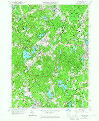
Editions of this 1964 Wrentham Map
2 editions found
Other maps of this area

1885 · Taunton
USGS Topo · 1:62,500

1886 · Dedham
USGS Topo · 1:62,500

1887 · Franklin
USGS Topo · 1:62,500

1887 · Providence
USGS Topo · 1:62,500

1888 · Taunton
USGS Topo · 1:62,500

1889 · Providence
USGS Topo · 1:62,500

1889 · Franklin
USGS Topo · 1:62,500

1893 · Taunton
USGS Topo · 1:62,500

1893 · Franklin
USGS Topo · 1:62,500

1894 · Dedham
USGS Topo · 1:62,500