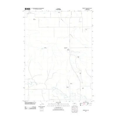
2011 Map of Wright Gap
USGS Topo · Published 2011About this map
Pumpkin Creek meanders through the southern half of this landscape, defining a valley surrounded by prominent landmarks of the Wildcat Hills region. Elevation changes are marked by distinctive formations like Bead Mountain, Big Haystack Mountain, and the iconic Castle Rock. The presence of the Fort Laramie Canal and Gering Canal in the north illustrates the managed water systems critical to this part of the Nebraska Panhandle. Several smaller impoundments, including the Brashear Group Dam and Darrell Roberts Dam, are scattered across the terrain, indicating localized agricultural water management. Human presence is concentrated along the section-line roads and at specific sites such as Creighton Cemetery and the Corr Airport, while Wright Gap provides a natural passage through the elevated ridges that dominate the central map area.
Find a feature on this map
28 named features on this map. Tap any name to fly to it.
Don’t see what you’re looking for? This feature index may not catch every label — zoom into the map to look around manually.
Map Details
Editions of this 2011 Wright Gap Map
This is the sole edition of this map. No revisions or reprints were ever made.
Other maps of this area

1898 · Scotts Bluff
USGS Topo · 1:125,000

1898 · Camp Clarke
USGS Topo · 1:125,000

1954 · Scottsbluff
USGS Topo · 1:250,000

1958 · Scottsbluff
USGS Topo · 1:250,000

1963 · Scottsbluff South
USGS Topo · 1:24,000

1965 · Minatare
USGS Topo · 1:24,000

1965 · Bayard SW
USGS Topo · 1:24,000

1965 · McGrew
USGS Topo · 1:24,000

1973 · Scotts Bluff 4 NW
USGS Topo · 1:24,000

1973 · Scotts Bluff 4 SE
USGS Topo · 1:24,000