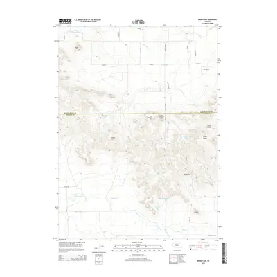
2014 Map of Wright Gap
USGS Topo · Published 2014About this map
The Wildcat Hills dominate this section of the Nebraska panhandle, creating a distinct escarpment that separates the irrigated North Platte Valley from the high plains. Within this broken terrain, notable landmarks such as Bead Mtn, Big Haystack Mtn, and the iconic Castle Rock rise above the drainage of Pumpkin Cr. The landscape reflects a legacy of water management, with the Fort Laramie Canal and Gering Canal skirting the northern breaks, alongside smaller catchments like Brashear Group Reservoir and Cannell Reservoir West.
Find a feature on this map
32 named features on this map. Tap any name to fly to it.
Don’t see what you’re looking for? This feature index may not catch every label — zoom into the map to look around manually.
Map Details
Editions of this 2014 Wright Gap Map
This is the sole edition of this map. No revisions or reprints were ever made.
Other maps of this area

1898 · Scotts Bluff
USGS Topo · 1:125,000

1898 · Camp Clarke
USGS Topo · 1:125,000

1954 · Scottsbluff
USGS Topo · 1:250,000

1958 · Scottsbluff
USGS Topo · 1:250,000

1963 · Scottsbluff South
USGS Topo · 1:24,000

1965 · Minatare
USGS Topo · 1:24,000

1965 · Bayard SW
USGS Topo · 1:24,000

1965 · McGrew
USGS Topo · 1:24,000

1973 · Scotts Bluff 4 NW
USGS Topo · 1:24,000

1973 · Scotts Bluff 4 SE
USGS Topo · 1:24,000