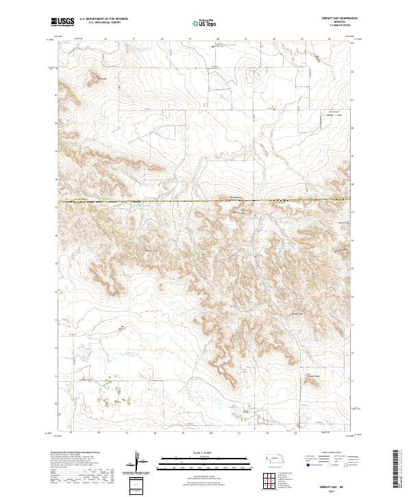
2021 Map of Wright Gap
USGS Topo · Published 2021About this map
The Wildcat Hills dominate this section of the Nebraska Panhandle, creating a high-relief corridor of prominent buttes and escarpments between the North Platte River valley and the southern plains. The landscape is defined by its verticality, featuring notable landmarks such as Bead Mtn, Big Haystack Mtn, and the iconic Castle Rock rising near the eastern edge. A network of rural section-line roads, including Wrights Gap Rd, navigates the complex terrain of Wright Gap and deep incisions like Bishop Canyon.
Find a feature on this map
37 named features on this map. Tap any name to fly to it.
Don’t see what you’re looking for? This feature index may not catch every label — zoom into the map to look around manually.
Map Details
Editions of this 2021 Wright Gap Map
This is the sole edition of this map. No revisions or reprints were ever made.
Other maps of this area

1898 · Scotts Bluff
USGS Topo · 1:125,000

1898 · Camp Clarke
USGS Topo · 1:125,000

1954 · Scottsbluff
USGS Topo · 1:250,000

1958 · Scottsbluff
USGS Topo · 1:250,000

1963 · Scottsbluff South
USGS Topo · 1:24,000

1965 · Minatare
USGS Topo · 1:24,000

1965 · Bayard SW
USGS Topo · 1:24,000

1965 · McGrew
USGS Topo · 1:24,000

1973 · Scotts Bluff 4 NW
USGS Topo · 1:24,000

1973 · Scotts Bluff 4 SE
USGS Topo · 1:24,000