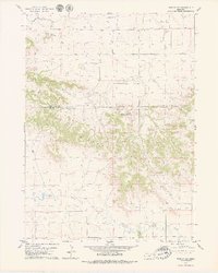
1979 Map of Wright Gap
USGS Topo · Published 1979About this map
The Wildcat Hills dominate this portion of the Nebraska Panhandle, carving a dramatic escarpment across the boundary between Scotts Bluff and Banner Counties. This 1970s survey captures the intricate topography of the region, from the high summits of Big Haystack Mountain and Little Haystack Mountain to the narrow passage at Wright Gap. The landscape reflects a dual reliance on natural water sources and large-scale engineering, featuring the winding Pumpkin Creek and the Fort Laramie Canal in the northern sections. For those interested in early settlement patterns, the Creighton Cem stands as a quiet marker in the northern plains, while geological and survey landmarks like Bead Mountain, Castle Rock, and various wells and drill holes indicate the intersection of cattle ranching and early mineral exploration in this high plains environment.
Find a feature on this map
14 named features on this map. Tap any name to fly to it.
Don’t see what you’re looking for? This feature index may not catch every label — zoom into the map to look around manually.
Map Details
Editions of this 1979 Wright Gap Map
This is the sole edition of this map. No revisions or reprints were ever made.
Other maps of this area

1898 · Scotts Bluff
USGS Topo · 1:125,000

1898 · Camp Clarke
USGS Topo · 1:125,000

1954 · Scottsbluff
USGS Topo · 1:250,000

1958 · Scottsbluff
USGS Topo · 1:250,000

1963 · Scottsbluff South
USGS Topo · 1:24,000

1965 · Minatare
USGS Topo · 1:24,000

1965 · Bayard SW
USGS Topo · 1:24,000

1965 · McGrew
USGS Topo · 1:24,000

1973 · Scotts Bluff 4 NW
USGS Topo · 1:24,000

1973 · Scotts Bluff 4 SE
USGS Topo · 1:24,000