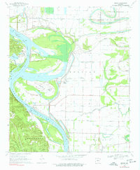
1970 Map of Wright
USGS Topo · Published 1977About this map
The Arkansas River winds through this 1970 survey, defining the landscape between Pulaski and Jefferson Counties. The region is characterized by complex hydrography, featuring oxbows and secondary channels such as Old River Lake and Hensley Island. Significant federal and institutional presence is noted in the southern portion of the map, where the Pine Bluff Arsenal and the Nat Center for Toxicological Research occupy large tracts of land.
Find a feature on this map
44 named features on this map. Tap any name to fly to it.
Don’t see what you’re looking for? This feature index may not catch every label — zoom into the map to look around manually.
Map Details
Editions of this 1970 Wright Map
2 editions found
Other maps of this area

1891 · Little Rock
USGS Topo · 1:125,000

1893 · Little Rock
USGS Topo · 1:125,000

1932 · Pastoria
USGS Topo · 1:62,500

1935 · Altheimer
USGS Topo · 1:62,500

1935 · Pastoria
USGS Topo · 1:62,500

1937 · England
USGS Topo · 1:48,000

1939 · Keo
USGS Topo · 1:31,680

1940 · Woodson
USGS Topo · 1:31,680

1941 · Keo
USGS Topo · 1:31,680

1943 · England
USGS Topo · 1:62,500