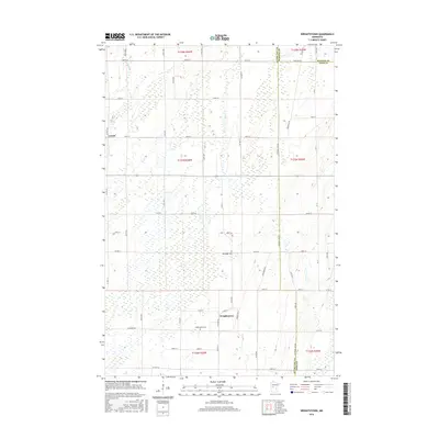
2016 Map of Wrightstown
USGS Topo · Published 2016About this map
Wrightstown serves as a central hub for this portion of the rural landscape where the boundaries of Otter Tail, Wadena, and Todd counties converge. The terrain is defined by a high concentration of small wetlands and depressions, characteristic of glacial till plains. Waterways like S Bluff Cr and Oak Cr wind through the township, which is anchored by the small settlement at Wrightstown and the community of Lyman to the northwest. For those researching local heritage, the map identifies key community sites such as Wrightstown Cem and Oak Ridge Cem. The road network is established on a rigid grid of avenues and streets, including Todd Line Rd, Church Rd, and Zimmerman Rd, reflecting the systematic agricultural development of the region.
Find a feature on this map
57 named features on this map. Tap any name to fly to it.
Don’t see what you’re looking for? This feature index may not catch every label — zoom into the map to look around manually.
Map Details
Editions of this 2016 Wrightstown Map
This is the sole edition of this map. No revisions or reprints were ever made.
Other maps of this area

1953 · Brainerd
USGS Topo · 1:250,000

1957 · Brainerd
USGS Topo · 1:250,000

1958 · Brainerd
USGS Topo · 1:250,000

1965 · Brainerd
USGS Topo · 1:250,000
1969 · Eagle Bend
USGS Topo · 1:24,000

1969 · Henning SE
USGS Topo · 1:24,000

1969 · Bertha
USGS Topo · 1:24,000

1969 · Wrightstown
USGS Topo · 1:24,000

1969 · Wadena
USGS Topo · 1:24,000
1969 · Eagle Bend NW
USGS Topo · 1:24,000