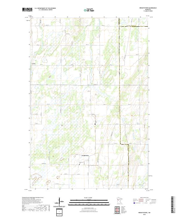
2022 Map of Wrightstown
USGS Topo · Published 2022About this map
Wrightstown and the surrounding township lands of t132n r36w anchor this 2022 survey of rural Otter Tail County. The landscape is defined by a dense network of sectional roads and glacial water features, including the meandering path of Bluff Cr and the northern reaches of Union Cr. Small-scale settlements like Lyman sit along established transit corridors such as Co Hwy 73, illustrating the persistent grid-based development of the Minnesota prairie. Local history and genealogy researchers will find key landmarks preserved in the digital topography, most notably the Wrightstown Cem and the Oak Ridge Cem located further north. The map details the transition between various township jurisdictions, including t134n r36w and t133n r36w, providing a clear view of the area's modern land divisions and rural infrastructure.
Find a feature on this map
54 named features on this map. Tap any name to fly to it.
Don’t see what you’re looking for? This feature index may not catch every label — zoom into the map to look around manually.
Map Details
Editions of this 2022 Wrightstown Map
This is the sole edition of this map. No revisions or reprints were ever made.
Other maps of this area

1953 · Brainerd
USGS Topo · 1:250,000

1957 · Brainerd
USGS Topo · 1:250,000

1958 · Brainerd
USGS Topo · 1:250,000

1965 · Brainerd
USGS Topo · 1:250,000
1969 · Eagle Bend
USGS Topo · 1:24,000

1969 · Henning SE
USGS Topo · 1:24,000

1969 · Bertha
USGS Topo · 1:24,000

1969 · Wrightstown
USGS Topo · 1:24,000

1969 · Wadena
USGS Topo · 1:24,000
1969 · Eagle Bend NW
USGS Topo · 1:24,000