
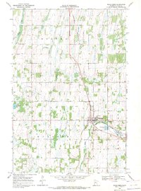
1969 Map of Wrightstown
USGS Topo · Published 1971About this map
Wrightstown anchors this landscape in the late 1960s, situated at the border of Otter Tail and Todd Counties. The terrain is defined by a series of distinct named regions including Oak Valley, Tower Prairie, and Woodside, where the land is carved by the winding paths of South Bluff Creek and Oak Creek. This survey captures a rural community structured around local institutions, featuring the Townhall, Union Corner Ch, and the United Church. For genealogists, the map provides precise locations for the Oak Ridge Cemetery and Wrightstown Cemetery. The presence of several Gravel Pits and the KWAD Radio Towers suggests the local industry and communication infrastructure of the era, while the small settlement of Lyman sits in the northwest corner, marking a quiet point of transition in this central Minnesota countryside.
Find a feature on this map
19 named features on this map. Tap any name to fly to it.
Don’t see what you’re looking for? This feature index may not catch every label — zoom into the map to look around manually.
Map Details
Editions of this 1969 Wrightstown Map
This is the sole edition of this map. No revisions or reprints were ever made.
Other maps of this area

1953 · Brainerd
USGS Topo · 1:250,000

1957 · Brainerd
USGS Topo · 1:250,000

1958 · Brainerd
USGS Topo · 1:250,000

1965 · Brainerd
USGS Topo · 1:250,000
1969 · Eagle Bend
USGS Topo · 1:24,000

1969 · Henning SE
USGS Topo · 1:24,000

1969 · Bertha
USGS Topo · 1:24,000

1969 · Wadena
USGS Topo · 1:24,000
1969 · Eagle Bend NW
USGS Topo · 1:24,000
1969 · Deer Creek
USGS Topo · 1:24,000