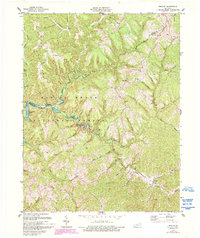
1977 Map of Wrigley
USGS Topo · Published 1993About this map
The North Fork Licking River winds through the heart of this Morgan County landscape, carving a deep valley through the Daniel Boone National Forest. In the late 1970s, the small community of Wrigley sits at the confluence of the river and Licking River, serving as a focal point for the surrounding ridge-and-hollow topography. The map reveals a network of rural life centered on family-named landmarks and small creek settlements like Blairs Mills, where the Blairs Mills Ch and local cemeteries provide essential data points for genealogical research.
Find a feature on this map
59 named features on this map. Tap any name to fly to it.
Don’t see what you’re looking for? This feature index may not catch every label — zoom into the map to look around manually.
Map Details
Editions of this 1977 Wrigley Map
2 editions found
Other maps of this area

1889 · Salyersville
USGS Topo · 1:125,000

1891 · Salyersville
USGS Topo · 1:125,000

1899 · Salyersville
USGS Topo · 1:125,000

1929 · Morehead
USGS Topo · 1:48,000

1935 · Morehead
USGS Topo · 1:62,500

1950 · Ault
USGS Topo · 1:24,000

1950 · Sandy Hook
USGS Topo · 1:24,000

1950 · Lenox
USGS Topo · 1:24,000

1951 · Ezel
USGS Topo · 1:24,000
1951 · Lenox
USGS Topo · 1:24,000