
1907 Map of Wyandotte
USGS Topo · Published 1954About this map
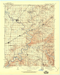
The Neosho River and Spring River converge in this territory, marking a landscape defined by its waterways and early transport networks before the era of large-scale damming. At this time, the St Louis and San Francisco RR provides the primary overland connection through burgeoning hubs like Miami, Afton, and Wyandotte. The map documents a critical period of settlement near the borders of Kansas and Missouri, showing a density of rural infrastructure that includes the Fort Scott And Miami Road and several vital river crossings such as Goad Eagle Ferry and Harlan Ferry. Genealogists will find a wealth of local landmarks, from the Hickory Grove Church to numerous country schools like Shiloh School and Aurora School. The terrain is punctuated by broad areas like Buffalo Prairie and Sweetwater Prairie, reflecting the region's transition from open grassland to a structured landscape of towns and township lines.
Find a feature on this map
85 named features on this map. Tap any name to fly to it.
Don’t see what you’re looking for? This feature index may not catch every label — zoom into the map to look around manually.
Map Details
Editions of this 1907 Wyandotte Map
2 editions found
Other maps of this area

1886 · Joplin
USGS Topo · 1:125,000

1886 · Carthage
USGS Topo · 1:125,000

1886 · Parsons
USGS Topo · 1:125,000

1893 · Parsons
USGS Topo · 1:125,000

1894 · Joplin
USGS Topo · 1:125,000

1894 · Carthage
USGS Topo · 1:125,000

1896 · Pryor
USGS Topo · 1:125,000

1899 · Fayetteville
USGS Topo · 1:125,000

1899 · Siloam Springs
USGS Topo · 1:125,000

1901 · Vinita
USGS Topo · 1:125,000