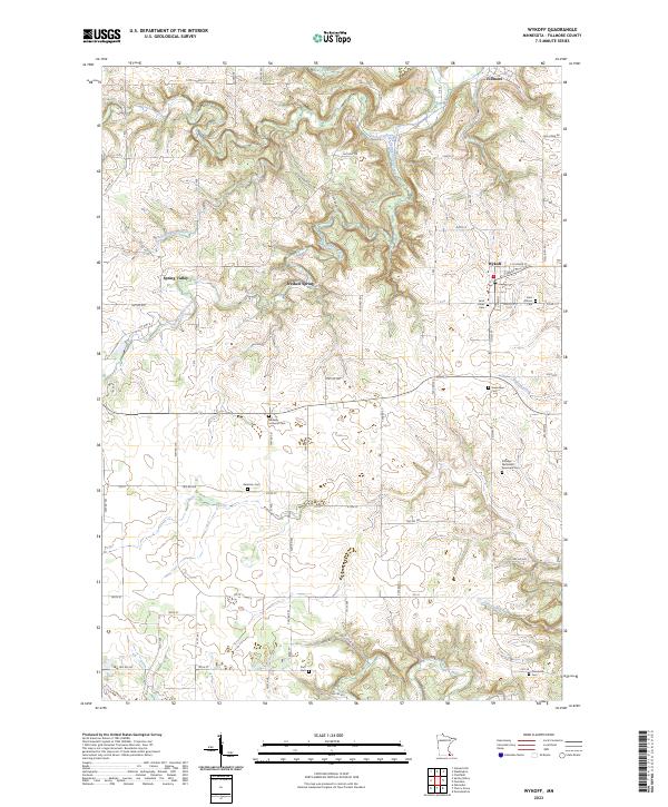
2023 Map of Wykoff
USGS Topo · Published 2023About this map
Wykoff and the northern settlement of Fillmore anchor this section of Fillmore County, where the agricultural landscape is deeply etched by the drainage of the South Branch Root River. The terrain is characterized by a dense network of watercourses including Deer Creek, Watson Creek, and Spring Valley Creek, which converge amidst a series of rural townships. A significant concentration of burial sites, such as the Saint Johns Cem and Saint Killian's Cem in Wykoff, as well as the outlying Midway Lutheran Cem and Duff Cem, provide critical points of interest for those tracing early families in the region. The map also features the natural Freiheit Spring, illustrating the hydrologic character of the driftless-area topography. Tracing the historic paths of Old Timber Br Rd and Oxen Rd reveals the enduring transportation framework that has connected these farming communities for generations.
Find a feature on this map
45 named features on this map. Tap any name to fly to it.
Don’t see what you’re looking for? This feature index may not catch every label — zoom into the map to look around manually.
Map Details
Editions of this 2023 Wykoff Map
This is the sole edition of this map. No revisions or reprints were ever made.
Other maps of this area

1954 · Chatfield
USGS Topo · 1:62,500

1954 · Mason City
USGS Topo · 1:250,000

1955 · Stewartville
USGS Topo · 1:62,500

1957 · Mason City
USGS Topo · 1:250,000

1958 · Mason City
USGS Topo · 1:250,000

1965 · Greenleafton
USGS Topo · 1:24,000

1965 · Wykoff
USGS Topo · 1:24,000

1965 · Spring Valley
USGS Topo · 1:24,000

1965 · Ostrander
USGS Topo · 1:24,000

1965 · Fountain
USGS Topo · 1:24,000