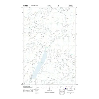
2011 Map of Wynoochee Lake
USGS Topo · Published 2011About this map
Wynoochee Lake dominates this Olympic Peninsula landscape, formed by the substantial Wynoochee Dam at its southern end. The surrounding terrain is a network of managed forest lands and high ridges, including the prominent Three Peaks and Anderson Butte, where the Anderson Butte Lookout once provided a vantage point over the timberlands. Recreational access is detailed through several sites like Coho Campground and the Wynoochee Falls Campground. The water system is particularly intricate, showing the headwaters of the Wynoochee River and its various tributaries such as Sixteen Creek and Eleanor Creek. Further east, the Satsop Lakes and the West Fork Satsop River indicate the drainage patterns of this high-precipitation region, while the Wynoochee Shelter marks a point of refuge in the north.
Find a feature on this map
28 named features on this map. Tap any name to fly to it.
Don’t see what you’re looking for? This feature index may not catch every label — zoom into the map to look around manually.
Map Details
Editions of this 2011 Wynoochee Lake Map
This is the sole edition of this map. No revisions or reprints were ever made.
Other maps of this area

1921 · Satsop
USGS Topo · 1:62,500

1938 · Mt Constance
USGS Topo · 1:125,000

1947 · Mt. Steel
USGS Topo · 1:62,500

1947 · Mt Christie
USGS Topo · 1:62,500

1950 · Mt Christie
USGS Topo · 1:62,500

1950 · Mt. Steel
USGS Topo · 1:62,500

1953 · Mt Tebo
USGS Topo · 1:62,500

1955 · Grisdale
USGS Topo · 1:62,500

1958 · Seattle
USGS Topo · 1:250,000

1962 · Seattle
USGS Topo · 1:250,000