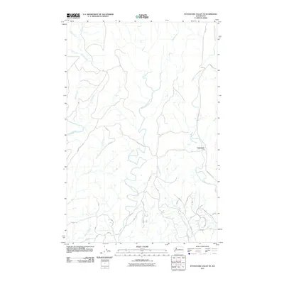
2011 Map of Wynoochee Valley NE
USGS Topo · Published 2011About this map
The Wynoochee River and the complex drainage systems of the Satsop river forks define this portion of Grays Harbor County in the early twenty-first century. This landscape is characterized by its intricate network of watercourses, including Schafer Creek, Neil Creek, and Canyon River, which carve through the terrain. The human presence is primarily marked by a dense system of resource management and access roads, such as A-Line and Wynoochee Valley Rd, reflecting the area's ongoing role in the regional timber and water management economy. Notable infrastructure includes the Cougar Smith Road Bridge, a key crossing over the Middle Fork Satsop River. The concentration of named forest roads like Muller Rd and the various numbered spurs suggests a highly managed environment where geographical features and industrial access are deeply intertwined.
Find a feature on this map
33 named features on this map. Tap any name to fly to it.
Don’t see what you’re looking for? This feature index may not catch every label — zoom into the map to look around manually.
Map Details
Editions of this 2011 Wynoochee Valley NE Map
This is the sole edition of this map. No revisions or reprints were ever made.
Other maps of this area

1921 · Satsop
USGS Topo · 1:62,500

1941 · Mobray
USGS Topo · 1:62,500

1943 · Nahwatzel Lake
USGS Topo · 1:62,500

1943 · Mobray
USGS Topo · 1:62,500

1953 · Mt Tebo
USGS Topo · 1:62,500

1953 · Elma
USGS Topo · 1:62,500

1955 · Wynoochee Valley
USGS Topo · 1:62,500

1955 · Grisdale
USGS Topo · 1:62,500

1958 · Seattle
USGS Topo · 1:250,000

1962 · Seattle
USGS Topo · 1:250,000