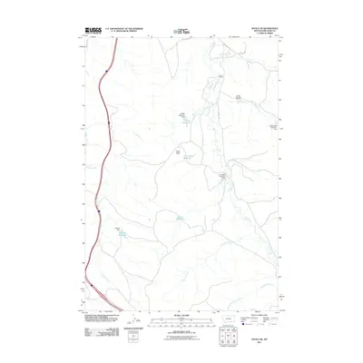
2011 Map of Wyola NE
USGS Topo · Published 2011About this map
The Little Bighorn River flows through the western edge of this Big Horn County landscape, where the high plains of Montana are defined by a network of seasonal drainages and local water management. The terrain is characterized by intermittent streams like Owl Creek, Lone Pine Creek, and Dry Beaver Creek that feed a series of small, strategically placed reservoirs and dams. These features, including the Liming Reservoir and Halfway Reservoir, speak to the critical importance of water conservation for ranching operations in this semi-arid region.
Find a feature on this map
23 named features on this map. Tap any name to fly to it.
Don’t see what you’re looking for? This feature index may not catch every label — zoom into the map to look around manually.
Map Details
Editions of this 2011 Wyola NE Map
This is the sole edition of this map. No revisions or reprints were ever made.
Other maps of this area

1894 · Rosebud
USGS Topo · 1:125,000

1901 · Rosebud
USGS Topo · 1:125,000

1954 · Hardin
USGS Topo · 1:250,000

1957 · Hardin
USGS Topo · 1:250,000

1958 · Hardin
USGS Topo · 1:250,000

1967 · Kid Creek
USGS Topo · 1:24,000

1967 · Wolf Mountain Lookout
USGS Topo · 1:24,000
1967 · Wyola
USGS Topo · 1:24,000
1967 · Wyola NE
USGS Topo · 1:24,000
1967 · Lodge Grass
USGS Topo · 1:24,000