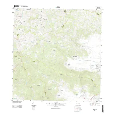
2013 Map of Yabucoa
USGS Topo · Published 2013About this map
Yabucoa and the surrounding coastal valleys on the Island of Puerto Rico are defined by a complex network of waterways and steep mountain ridges. The Valle de Yabucoa serves as a central hub for the region, where the Rio Guayanés flows toward the coast near Central Roig and Martorell. To the south, the Cuchilla de Panduras forms a significant topographic barrier separating the Yabucoa basin from the Maunabo valley, which is drained by the Rio Maunabo before it reaches the Caribbean Sea. Numerous family-named roads, such as Camino Juan Perez and Camino Vicente Gonzalez, snake through the high elevations of the Sierra de Guardarraya and around peaks like Pico Lebrón. This intricate network of rural paths provides insight into the dispersed settlement patterns and local land usage in the rugged interior of the southeast coast.
Find a feature on this map
79 named features on this map. Tap any name to fly to it.
Don’t see what you’re looking for? This feature index may not catch every label — zoom into the map to look around manually.
Map Details
Editions of this 2013 Yabucoa Map
This is the sole edition of this map. No revisions or reprints were ever made.
Other maps of this area

1945 · Punta Tuna
USGS Topo · 1:30,000

1946 · Patillas
USGS Topo · 1:30,000

1946 · Humacao
USGS Topo · 1:30,000

1946 · Punta Guayanes
USGS Topo · 1:30,000

1946 · Juncos
USGS Topo · 1:30,000

1946 · Yabucoa
USGS Topo · 1:30,000

1946 · Guayama
USGS Topo · 1:30,000

1946 · Caguas
USGS Topo · 1:30,000
1947 · Humacao SO
USGS Topo · 1:10,000

1947 · Yabucoa SO
USGS Topo · 1:10,000