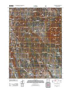
2011 Map of Yainax Butte
USGS Topo · Published 2011About this map
Kitts Mill and the nearby Sawmill Field anchor the eastern slopes of this high-desert landscape in southern Oregon, where the timber and ranching economy has long shaped the land. Water management is central to this territory, evidenced by an extensive network of impoundments including Keno Reservoir, held by the Keno Dam, and high-elevation basins like Bechdoldt Reservoir and May Reservoir. Rising above the surrounding terrain, Yainax Butte serves as a dominant landmark, overlooking a series of expansive flats and prairies such as Coyote Flat, Round Prairie, and Mortar Prairie. The distribution of Keno Springs Ranch and various named springs like John Spring and Nuthatch Springs illustrates the vital importance of water sources in this Klamath County environment.
Find a feature on this map
62 named features on this map. Tap any name to fly to it.
Don’t see what you’re looking for? This feature index may not catch every label — zoom into the map to look around manually.
Map Details
Editions of this 2011 Yainax Butte Map
This is the sole edition of this map. No revisions or reprints were ever made.
Other maps of this area

1889 · Klamath
USGS Topo · 1:250,000

1894 · Klamath
USGS Topo · 1:250,000

1955 · Klamath Falls
USGS Topo · 1:250,000

1957 · Malin
USGS Topo · 1:62,500

1958 · Klamath Falls
USGS Topo · 1:250,000

1960 · Gerber Reservoir
USGS Topo · 1:62,500

1960 · Bly
USGS Topo · 1:62,500

1960 · Beatty
USGS Topo · 1:62,500
1988 · Yainax Butte
USGS Topo · 1:24,000
1988 · Bonanza
USGS Topo · 1:24,000