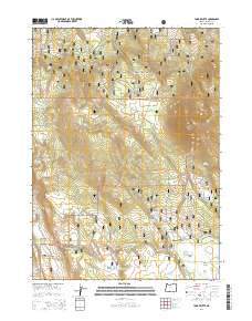
2014 Map of Yainax Butte
USGS Topo · Published 2014About this map
Yainax Butte dominates the northeastern landscape of this high-altitude terrain within the Fremont National Forest. The geography is defined by a complex network of springs and small reservoirs that sustain the high desert and forested plateaus, including May Reservoir, Keno Reservoir, and Bechdoldt Reservoir. These water sources are vital to the area's grazing and logging heritage, as evidenced by the open expanses of Sawmill Field and Coyote Flat.
Find a feature on this map
60 named features on this map. Tap any name to fly to it.
Don’t see what you’re looking for? This feature index may not catch every label — zoom into the map to look around manually.
Map Details
Editions of this 2014 Yainax Butte Map
This is the sole edition of this map. No revisions or reprints were ever made.
Other maps of this area

1889 · Klamath
USGS Topo · 1:250,000

1894 · Klamath
USGS Topo · 1:250,000

1955 · Klamath Falls
USGS Topo · 1:250,000

1957 · Malin
USGS Topo · 1:62,500

1958 · Klamath Falls
USGS Topo · 1:250,000

1960 · Gerber Reservoir
USGS Topo · 1:62,500

1960 · Bly
USGS Topo · 1:62,500

1960 · Beatty
USGS Topo · 1:62,500
1988 · Yainax Butte
USGS Topo · 1:24,000
1988 · Bonanza
USGS Topo · 1:24,000