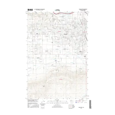
2017 Map of Yakima West
USGS Topo · Published 2017About this map
The Naches River and its intricate network of irrigation systems, including the Union Canal and Congdon Canal, anchor this detailed survey of the western Yakima area. The landscape is defined by the sharp transition from the residential street grids of Yakima and South Broadway to the elevated basalt plateaus of Naches Heights and the prominent Ahtanum Ridge to the south. Local history is deeply embedded in the layout of unincorporated communities like Fruitvale, Ahtanum, and Wide Hollow, which are separated by significant natural features such as Cowiche Canyon. The presence of several burial sites, including Yemowat Cem and Tahoma Cem, along with the aviation hub at Yakima Air Terminal/McAllister Field, illustrates the region's development as a central agricultural and transport nexus in the valley.
Find a feature on this map
107 named features on this map. Tap any name to fly to it.
Don’t see what you’re looking for? This feature index may not catch every label — zoom into the map to look around manually.
Map Details
Editions of this 2017 Yakima West Map
This is the sole edition of this map. No revisions or reprints were ever made.
Other maps of this area

1899 · Ellensburg
USGS Topo · 1:125,000

1901 · Ellensburg
USGS Topo · 1:125,000

1910 · Zillah
USGS Topo · 1:125,000

1936 · Yakima East
USGS Topo · 1:48,000

1937 · White Swan
USGS Topo · 1:125,000

1941 · Yakima East
USGS Topo · 1:62,500

1950 · Yakima
USGS Topo · 1:250,000

1953 · Pomona
USGS Topo · 1:24,000

1953 · Yakima East
USGS Topo · 1:24,000
1953 · Yakima East
USGS Topo · 1:62,500