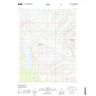
2017 Map of Yakutat B-2 SE
USGS Topo · Published 2017About this map
Tanis Mesa and the expansive glacial systems of the southeastern Alaska coast define this landscape within the Tongass National Forest and Glacier Bay National Park. The map records a complex hydrological environment where massive ice bodies like Novatak Glacier, Martin Glacier, and Chamberlain Glacier feed into the low-lying basin of Tanis Lake. The presence of the Tanis Mesa Airport near the mouth of the Tanis River indicates the critical role of bush aviation in accessing this roadless wilderness. This survey captures the precise positioning of terminal moraines and drainage patterns, such as Gines Cr and Emile Cr, providing a baseline for studying the shifting ice margins in this protected coastal corridor.
Find a feature on this map
19 named features on this map. Tap any name to fly to it.
Don’t see what you’re looking for? This feature index may not catch every label — zoom into the map to look around manually.
Map Details
Editions of this 2017 Yakutat B-2 SE Map
This is the sole edition of this map. No revisions or reprints were ever made.
Other maps of this area

1951 · Yakutat
USGS Topo · 1:250,000

1959 · Yakutat A-1
USGS Topo · 1:63,360

1959 · Yakutat A-2
USGS Topo · 1:63,360

1959 · Yakutat B-2
USGS Topo · 1:63,360

1959 · Yakutat B-1
USGS Topo · 1:63,360

1959 · Yakutat
USGS Topo · 1:250,000

1997 · Yakutat B-1
USGS Topo · 1:63,360
2017 · Yakutat A-1 NW
USGS Topo · 1:25,000
2017 · Yakutat B-2 NE
USGS Topo · 1:25,000
2017 · Yakutat B-2 NW
USGS Topo · 1:25,000