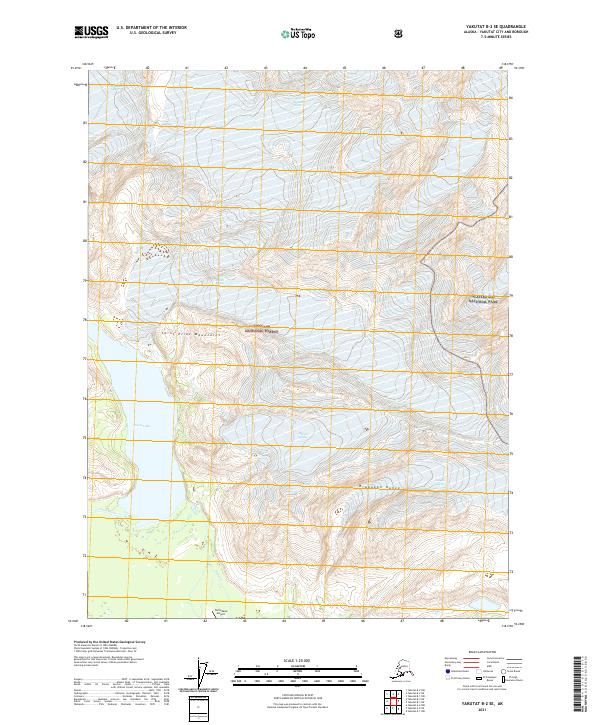
2021 Map of Yakutat B-2 SE
USGS Topo · Published 2021About this map
Novatak Glacier and Mactavish Glacier dominate the northern reaches of this coastal Alaskan landscape, where the ice fields of the Saint Elias Mountains meet the protected expanses of Tongass National Forest and Glacier Bay National Park. The survey illustrates a dynamic hydrological system where glacial melt feeds into Tanis Lake and the Tanis River, creating a complex network of braided streams and wetlands. In the southern portion of the map, the Tanis Mesa Airport sits as a lonely mark of infrastructure between the Brabazon Range and the shifting waters of Gines Cr. This terrain highlights the intersection of massive ice bodies like Canyon Glacier with the low-lying drainage basins that flow toward the Gulf of Alaska coast.
Find a feature on this map
18 named features on this map. Tap any name to fly to it.
Don’t see what you’re looking for? This feature index may not catch every label — zoom into the map to look around manually.
Map Details
Editions of this 2021 Yakutat B-2 SE Map
This is the sole edition of this map. No revisions or reprints were ever made.
Other maps of this area

1951 · Yakutat
USGS Topo · 1:250,000

1959 · Yakutat A-1
USGS Topo · 1:63,360

1959 · Yakutat A-2
USGS Topo · 1:63,360

1959 · Yakutat B-2
USGS Topo · 1:63,360

1959 · Yakutat B-1
USGS Topo · 1:63,360

1959 · Yakutat
USGS Topo · 1:250,000

1997 · Yakutat B-1
USGS Topo · 1:63,360
2017 · Yakutat A-1 NW
USGS Topo · 1:25,000
2017 · Yakutat B-2 NE
USGS Topo · 1:25,000
2017 · Yakutat B-2 NW
USGS Topo · 1:25,000