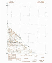
1985 Map of Yakutat C-1
USGS Topo · Published 1985About this map
Tongass National Forest covers the mountainous terrain of the Saint Elias Mountains in this 1985 survey, where the landscape is defined by massive ice fields and glacial movements. The international border between Canada and the United States and the regional boundary between British Columbia and Alaska bisect the rugged peaks, illustrating the remote geopolitical intersection of the Pacific Northwest. The presence of numerous Glacier features and a prominent Moraine highlight an environment shaped by heavy glaciation. This map, compiled from 1958 aerial photography, records the physical state of these ice masses before late twentieth-century shifts, providing a topographic baseline for the region’s high-altitude geography and federal reservation boundaries established by the Alaska National Interest Lands Conservation Act.
Find a feature on this map
5 named features on this map. Tap any name to fly to it.
Don’t see what you’re looking for? This feature index may not catch every label — zoom into the map to look around manually.
Map Details
Editions of this 1985 Yakutat C-1 Map
This is the sole edition of this map. No revisions or reprints were ever made.
Other maps of this area

1951 · Yakutat
USGS Topo · 1:250,000

1952 · Skagway
USGS Topo · 1:250,000

1959 · Yakutat B-2
USGS Topo · 1:63,360

1959 · Yakutat B-1
USGS Topo · 1:63,360

1959 · Yakutat
USGS Topo · 1:250,000
1961 · Skagway B-8
USGS Topo · 1:63,360

1961 · Skagway
USGS Topo · 1:250,000

1985 · Yakutat C-2
USGS Topo · 1:63,360
1985 · Yakutat D-2
USGS Topo · 1:63,360

1997 · Yakutat B-1
USGS Topo · 1:63,360