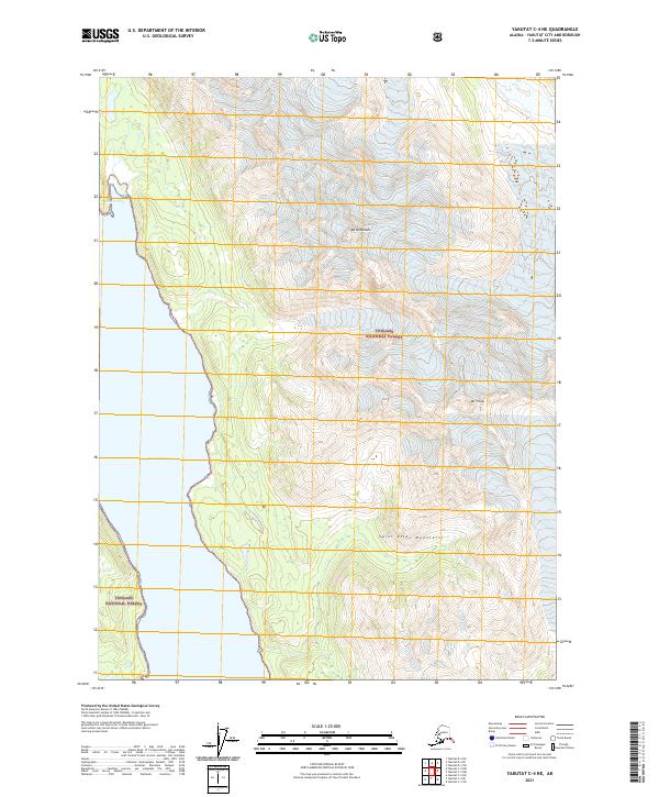
2021 Map of Yakutat C-4 NE
USGS Topo · Published 2021About this map
Russell Fiord carves into the Alaskan coastline on this sheet, defining a landscape where the Saint Elias Mountains meet the sea. This high-altitude coastal region is entirely contained within the Tongass National Forest, showcasing a transition from the marine environment of Shelter Cove to the steep peaks of Mt Ruhamah and Mt Pinta. The map documents a wilderness primarily defined by glacial geology and protected forest lands, with no established roads or settlements present in this specific sector. Instead, the focus remains on the dramatic elevation changes and the intricate shoreline of the fjord, providing a detailed record of this remote terrain in the early twenty-first century.
Find a feature on this map
10 named features on this map. Tap any name to fly to it.
Don’t see what you’re looking for? This feature index may not catch every label — zoom into the map to look around manually.
Map Details
Editions of this 2021 Yakutat C-4 NE Map
This is the sole edition of this map. No revisions or reprints were ever made.
Other maps of this area

1951 · Yakutat
USGS Topo · 1:250,000

1959 · Yakutat C-3
USGS Topo · 1:63,360

1959 · Yakutat D-3
USGS Topo · 1:63,360

1959 · Yakutat D-4
USGS Topo · 1:63,360

1959 · Yakutat C-4
USGS Topo · 1:63,360

1959 · Yakutat
USGS Topo · 1:250,000

1987 · Yakutat C-4 SW
USGS Topo · 1:25,000
1987 · Yakutat C-4 SE
USGS Topo · 1:25,000
1997 · Yakutat C-4
USGS Topo · 1:63,360
2017 · Yakutat D-4 SW
USGS Topo · 1:25,000