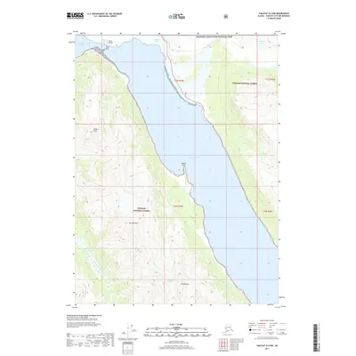
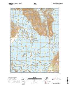
2017 Map of Yakutat D-4 NW
USGS Topo · Published 2017About this map
Hubbard Glacier and Variegated Glacier dominate the northern margins of this coastal Alaska landscape, where ice meets the tides of Disenchantment Bay. The map documents a significant intersection of protected lands, showing the boundary between Wrangell-Saint Elias National Park and the Tongass National Forest. The geography is defined by the long, deep reach of Russell Fiord, which is pinched by Gilbert Point and Osier Island at its northern mouth. High alpine features like Mt Alexander and the Alexander Glacier rise sharply from the eastern shore, illustrating the dramatic vertical relief typical of the region. Coastal landmarks such as Marble Point and the outflow of Calahonda Creek provide specific points of reference along the waterline in this largely untracked wilderness.
Find a feature on this map
17 named features on this map. Tap any name to fly to it.
Don’t see what you’re looking for? This feature index may not catch every label — zoom into the map to look around manually.
Map Details
Editions of this 2017 Yakutat D-4 NW Map
This is the sole edition of this map. No revisions or reprints were ever made.
Other maps of this area

1951 · Yakutat
USGS Topo · 1:250,000

1951 · Mt Saint Elias
USGS Topo · 1:250,000

1959 · Yakutat D-4
USGS Topo · 1:63,360

1959 · Yakutat D-5
USGS Topo · 1:63,360

1959 · Yakutat
USGS Topo · 1:250,000

1959 · Mt Saint Elias
USGS Topo · 1:250,000
1985 · Mount Saint Elias A-5
USGS Topo · 1:63,360
1985 · Mount Saint Elias A-4
USGS Topo · 1:63,360
2017 · Mount Saint Elias A-4 SE
USGS Topo · 1:25,000
2017 · Mount Saint Elias A-4 SW
USGS Topo · 1:25,000