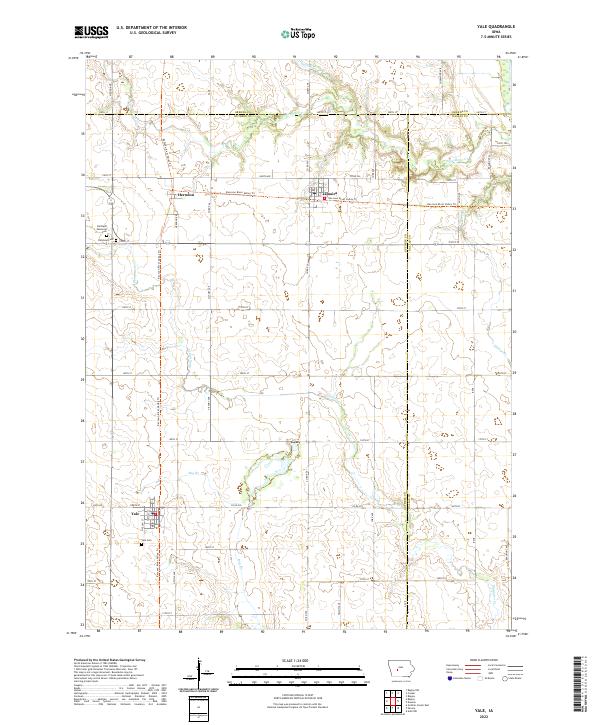
2022 Map of Yale
USGS Topo · Published 2022About this map
Yale, Jamaica, and Herndon anchor this central Iowa landscape, positioned where Guthrie, Greene, and Dallas counties converge. The terrain is defined by the winding paths of Mosquito Cr and Bay Br, which drain the agricultural heartland between the towns. A significant modern feature is the Raccoon River Valley Trl, which utilizes the old rail corridor to connect these rural communities, passing directly through the centers of Herndon and Jamaica. Local genealogy and history are preserved at several sites, including the Richland Memorial Cem and Richland Cem near the western edge of the map, and the Yale Cem just south of its namesake town. The intricate section-line road network, including routes like Neola Ave and Co Rd P30, reflects the enduring grid system of the Great Plains, providing a clear view of the area's contemporary rural structure.
Find a feature on this map
60 named features on this map. Tap any name to fly to it.
Don’t see what you’re looking for? This feature index may not catch every label — zoom into the map to look around manually.
Map Details
Editions of this 2022 Yale Map
This is the sole edition of this map. No revisions or reprints were ever made.
Other maps of this area

1949 · Adel
USGS Topo · 1:62,500

1950 · Perry
USGS Topo · 1:62,500

1951 · Perry
USGS Topo · 1:62,500

1951 · Adel
USGS Topo · 1:62,500

1952 · Panora
USGS Topo · 1:62,500

1954 · Bagley
USGS Topo · 1:62,500

1954 · Omaha
USGS Topo · 1:250,000

1957 · Omaha
USGS Topo · 1:250,000

1958 · Omaha
USGS Topo · 1:250,000
1982 · Rippey
USGS Topo · 1:24,000