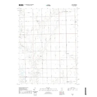
2021 Map of Yale
USGS Topo · Published 2021About this map
Yale and Hunt City anchor the northern and central sections of this Jasper County landscape, characterized by a dense grid of range and township roads that delineate the agricultural heartland of eastern Illinois. The terrain is defined by the winding paths of Crooked Cr and its tributaries, including W Crooked Cr and E Crooked Cr, which cut through the level plains and create pockets of wooded relief. This area is particularly significant for genealogical research due to the high density of small rural burial grounds, such as Brockville Cem, Matteson Cem, and the distinct Old Saint Peter Cem and New Saint Peter Cem sites. In the southern portion, Willow Hill sits near the headwaters of Camp Cr, while man-made water bodies like Lake Jasper and Lake Sandpoint indicate local infrastructure and recreational developments within the traditional farming tracts. The map preserves the exact alignment of historical county roads, including Co HWY 14, providing a clear record of local connectivity.
Find a feature on this map
66 named features on this map. Tap any name to fly to it.
Don’t see what you’re looking for? This feature index may not catch every label — zoom into the map to look around manually.
Map Details
Editions of this 2021 Yale Map
This is the sole edition of this map. No revisions or reprints were ever made.
Other maps of this area

1910 · Hardinville
USGS Topo · 1:62,500

1940 · Greenup
USGS Topo · 1:62,500

1941 · Newton
USGS Topo · 1:62,500

1943 · Greenup
USGS Topo · 1:62,500

1943 · Newton
USGS Topo · 1:62,500

1953 · Indianapolis
USGS Topo · 1:250,000

1956 · Indianapolis
USGS Topo · 1:250,000

1956 · Annapolis
USGS Topo · 1:62,500

1956 · Vincennes
USGS Topo · 1:250,000

1957 · Indianapolis
USGS Topo · 1:250,000