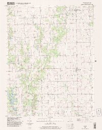
1998 Map of Yale
USGS Topo · Published 2002About this map
Sam Parr State Park dominates the southwestern corner of this Jasper County landscape, centered on the waters of Lake Jasper and a network of recreation paths including the Foot Path and Foot Trail. The topography is defined by the winding course of Crooked Creek, which bifurcates into its East Fork and West Fork as it moves north toward Yale. The 1990s character of the region is a blend of conservation land and active resource extraction, evidenced by numerous Well Fields and drill holes scattered across the townships.
Find a feature on this map
17 named features on this map. Tap any name to fly to it.
Don’t see what you’re looking for? This feature index may not catch every label — zoom into the map to look around manually.
Map Details
Editions of this 1998 Yale Map
This is the sole edition of this map. No revisions or reprints were ever made.
Other maps of this area

1910 · Hardinville
USGS Topo · 1:62,500

1940 · Greenup
USGS Topo · 1:62,500

1941 · Newton
USGS Topo · 1:62,500

1943 · Greenup
USGS Topo · 1:62,500

1943 · Newton
USGS Topo · 1:62,500

1953 · Indianapolis
USGS Topo · 1:250,000

1956 · Indianapolis
USGS Topo · 1:250,000

1956 · Annapolis
USGS Topo · 1:62,500

1956 · Vincennes
USGS Topo · 1:250,000

1957 · Indianapolis
USGS Topo · 1:250,000