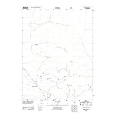
2012 Map of Yankee Blade
USGS Topo · Published 2012About this map
Yankee Blade and the surrounding high desert terrain of Lander County are characterized by a network of seasonal water sources and deep-cut canyons. The landscape is marked by historic nomenclature including San Francisco Canyon and New York Canyon, suggesting the geographic reach of 19th-century prospecting. Ranching and transit are central to the layout, with Burtons Ranch situated in the northwest and Emigrant Pass serving as a traditional route through the ridges. Water management is evident through numerous named springs, such as Cottonwood Spring Number One, Bud Springs, and Upper Midas Spring, which supported the livestock and travelers in this arid environment. To the south, China Ridge and Slaughterhouse Canyon provide topographic contrast, while the presence of Telegraph Peak indicates a history of communication and vantage points over the basin.
Find a feature on this map
43 named features on this map. Tap any name to fly to it.
Don’t see what you’re looking for? This feature index may not catch every label — zoom into the map to look around manually.
Map Details
Editions of this 2012 Yankee Blade Map
This is the sole edition of this map. No revisions or reprints were ever made.
Other maps of this area

1926 · Roberts Mountains
USGS Topo · 1:250,000

1929 · Roberts Mountains
USGS Topo · 1:250,000

1955 · Millett
USGS Topo · 1:250,000

1956 · Mount Callaghan
USGS Topo · 1:62,500

1956 · Austin
USGS Topo · 1:62,500

1959 · Millett
USGS Topo · 1:250,000

1960 · Spencer Hot Springs
USGS Topo · 1:62,500

1969 · Yankee Blade
USGS Topo · 1:24,000

1969 · Vigus Butte NE
USGS Topo · 1:24,000

1969 · Vigus Butte
USGS Topo · 1:24,000