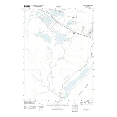
2010 Map of Yankee Lake
USGS Topo · Published 2010About this map
Rock Hill and the surrounding lake communities define this Catskill-fringe landscape at the opening of the 21st century. The map detail reflects a region historically shaped by resort life and seasonal residents, where water bodies like Wanaksink Lake, Lake Louise Marie, and Mastens Lake are clustered with dense road networks and small settlement cores. To the south, the terrain descends toward the Shawangunk Mountains and the broad valley of the Basher Kill. This transition from the upland lake plateau to the river valley is marked by rural outposts such as Culvertown and Haven. Significant for local history researchers, the map identifies the Belle Terre Cemetery near Westbrookville, alongside the winding course of the Pine Kill. The infrastructure of the era is anchored by major corridors like Co Rd 172 and Wurtsboro Mountain Rd, which connect these historically distinct lakeside enclaves.
Find a feature on this map
57 named features on this map. Tap any name to fly to it.
Don’t see what you’re looking for? This feature index may not catch every label — zoom into the map to look around manually.
Map Details
Editions of this 2010 Yankee Lake Map
This is the sole edition of this map. No revisions or reprints were ever made.
Other maps of this area

1904 · Ellenville
USGS Topo · 1:62,500

1906 · Ellenville
USGS Topo · 1:62,500

1906 · Port Jervis
USGS Topo · 1:62,500

1906 · Goshen
USGS Topo · 1:62,500

1908 · Goshen
USGS Topo · 1:62,500

1908 · Port Jervis
USGS Topo · 1:62,500

1909 · Monticello
USGS Topo · 1:62,500

1911 · Monticello
USGS Topo · 1:62,500

1938 · Goshen
USGS Topo · 1:62,500

1942 · Port Jervis North
USGS Topo · 1:24,000