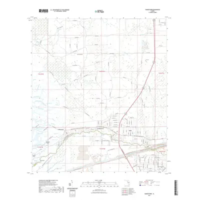
2021 Map of Yankeetown
USGS Topo · Published 2021About this map
Inglis and Yankeetown occupy a landscape defined by the intersection of freshwater springs and the Gulf of Mexico's tidal influence. This coastal reach of the Withlacoochee River is marked by a complex network of creeks such as Jones Creek, Fuller Creek, and Trout Creek which carve through a mosaic of islands including Helverson Island and Pumpkin Island. The lower portion of the map is dominated by the massive engineering of the Cross Florida Barge Canal, which runs parallel to the natural river channel, illustrating the mid-century attempt to connect the Gulf and Atlantic coasts.
Find a feature on this map
155 named features on this map. Tap any name to fly to it.
Don’t see what you’re looking for? This feature index may not catch every label — zoom into the map to look around manually.
Map Details
Editions of this 2021 Yankeetown Map
This is the sole edition of this map. No revisions or reprints were ever made.
Other maps of this area

1954 · Crystal River
USGS Topo · 1:24,000

1954 · Red Level
USGS Topo · 1:24,000

1954 · Yankeetown SE
USGS Topo · 1:24,000

1954 · Gainesville
USGS Topo · 1:250,000

1955 · Lebanon Station
USGS Topo · 1:24,000

1955 · Withlacoochee Bay
USGS Topo · 1:24,000

1955 · Waccasassa Bay
USGS Topo · 1:24,000

1955 · Yankeetown
USGS Topo · 1:24,000

1955 · Tidewater
USGS Topo · 1:24,000

1955 · Plant City
USGS Topo · 1:250,000