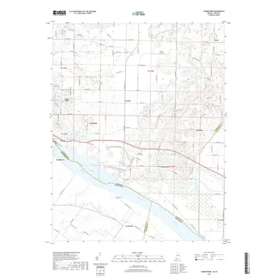
2019 Map of Yankeetown
USGS Topo · Published 2019About this map
The Ohio River serves as the dominant geographical boundary for this riverfront landscape, separating the bottomlands of Indiana from Kentucky. Along the northern bank, the settlements of Newburgh and Yankeetown are connected by a network of rural roads and highways, including Co RD 700 S. The interior is defined by a mix of agricultural plots and small communities such as Dayville and Pelzer, while the floodplain near Scuffletown shows the drainage patterns of the Griffith Slough Ditch and Little Pigeon Creek.
Find a feature on this map
102 named features on this map. Tap any name to fly to it.
Don’t see what you’re looking for? This feature index may not catch every label — zoom into the map to look around manually.
Map Details
Editions of this 2019 Yankeetown Map
This is the sole edition of this map. No revisions or reprints were ever made.
Other maps of this area

1900 · De Gonia Springs
USGS Topo · 1:62,500

1901 · Owensboro
USGS Topo · 1:62,500

1902 · Ditney
USGS Topo · 1:125,000

1902 · Degonia Springs
USGS Topo · 1:62,500

1902 · Boonville
USGS Topo · 1:62,500

1905 · Newburg
USGS Topo · 1:62,500

1951 · Yankeetown
USGS Topo · 1:24,000

1951 · Spottsville
USGS Topo · 1:24,000

1952 · Owensboro West
USGS Topo · 1:24,000

1952 · Newburgh
USGS Topo · 1:24,000