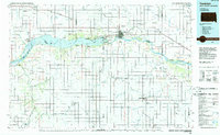
1985 Map of Yankton
USGS Topo · Published 1985About this map
The Missouri River and the expansive Lewis and Clark Lake dominate this mid-1980s landscape at the South Dakota and Nebraska border. Formed by the Gavins Point Dam, the lake is flanked by recreational sites such as the Bloomfield Recreation Area and the Gavins Point National Fish Hatchery. To the south, the Santee Indian Reservation encompasses much of the Nebraska territory, centered around the settlement of Santee. Transportation networks of the era are clearly defined, featuring the Burlington Northern and Chicago and North Western rail lines. Significant regional hubs like Yankton, home to the Chan Gurney Municipal Airport, and Tyndall serve as anchors for the surrounding agricultural prairie, while the James River and Vermillion River snake through the northern plains to join the Missouri.
Find a feature on this map
75 named features on this map. Tap any name to fly to it.
Don’t see what you’re looking for? This feature index may not catch every label — zoom into the map to look around manually.
Map Details
Editions of this 1985 Yankton Map
2 editions found
Other maps of this area

1897 · Canton
USGS Topo · 1:125,000

1898 · Olivet
USGS Topo · 1:125,000

1898 · Parker
USGS Topo · 1:125,000

1898 · Elk Point
USGS Topo · 1:125,000

1900 · Canton
USGS Topo · 1:125,000

1901 · Elk Point
USGS Topo · 1:125,000

1907 · Elk Point
USGS Topo · 1:125,000

1950 · Niobrara
USGS Topo · 1:24,000

1950 · Verdigre NE
USGS Topo · 1:24,000

1954 · Verdigre
USGS Topo · 1:24,000