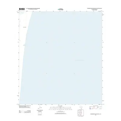
2013 Map of Yarborough Pass OE E
USGS Topo · Published 2013About this map
Padre Island defines the western edge of this coastal survey, where the barrier island's narrow stretch meets the vast expanse of the Gulf of Mexico. The landscape is dominated by the dynamic interaction of water and sand, centered on the notable Yarborough Pass. This specific coastal notch represents a historical attempt at dredging to improve water circulation between the Gulf and the Laguna Madre, a project significant to local ecological management and maritime history. The map primarily captures the open sea and the shoreline, showing a moment in the early 21st century before natural shifting and storm events continue to reshape the fragile barrier island geography of Kenedy County.
Find a feature on this map
3 named features on this map. Tap any name to fly to it.
Don’t see what you’re looking for? This feature index may not catch every label — zoom into the map to look around manually.
Map Details
Editions of this 2013 Yarborough Pass OE E Map
This is the sole edition of this map. No revisions or reprints were ever made.
Other maps of this area

1950 · Corpus Christi
USGS Topo · 1:250,000

1951 · South Bird Island SE
USGS Topo · 1:24,000

1951 · Point Of Rocks
USGS Topo · 1:24,000

1951 · South Bird Island
USGS Topo · 1:62,500

1952 · Potrero Cortado
USGS Topo · 1:24,000

1952 · Yarborough Pass
USGS Topo · 1:24,000
1955 · Potrero Cortado
USGS Topo · 1:62,500

1956 · Corpus Christi
USGS Topo · 1:250,000

1960 · Corpus Christi
USGS Topo · 1:250,000

1966 · Corpus Christi
USGS Topo · 1:250,000