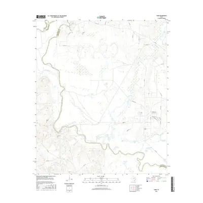
2016 Map of Yard
USGS Topo · Published 2016About this map
The Trinity River defines the western and southern boundaries of this area along the Anderson and Freestone County line, winding through a complex landscape of oxbow lakes and wetlands. The river's historical influence is evident in the numerous water bodies that dot the floodplain, including Cook Lake, Tyler Ferry Lake, and Patterson Lake. These features, along with names like Cedar Lake Slough and Goose Pond, suggest a terrain shaped by seasonal flooding and shifting river channels.
Find a feature on this map
53 named features on this map. Tap any name to fly to it.
Don’t see what you’re looking for? This feature index may not catch every label — zoom into the map to look around manually.
Map Details
Editions of this 2016 Yard Map
This is the sole edition of this map. No revisions or reprints were ever made.
Other maps of this area

1919 · Fairfield
USGS Topo · 1:62,500

1949 · Tennessee Colony
USGS Topo · 1:62,500

1950 · Tennessee Colony
USGS Topo · 1:62,500

1953 · Palestine
USGS Topo · 1:250,000

1954 · Waco
USGS Topo · 1:250,000

1955 · Waco
USGS Topo · 1:250,000

1957 · Palestine
USGS Topo · 1:250,000

1960 · Roustabout Camp
USGS Topo · 1:24,000

1961 · Young
USGS Topo · 1:24,000

1964 · Long Lake
USGS Topo · 1:24,000