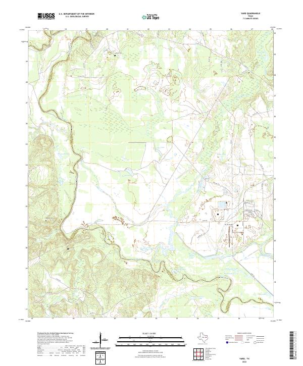
2022 Map of Yard
USGS Topo · Published 2022About this map
The Trinity River snakes across this landscape, forming the natural boundary between Freestone and Anderson counties. This riverine environment is defined by an intricate network of oxbow lakes, sloughs, and wetlands, including Patterson Lake, Tyler Ferry Lake, and Mossy Lake. The name Tyler Ferry Lake suggests the historical importance of river crossings in this region before modern infrastructure.
Find a feature on this map
52 named features on this map. Tap any name to fly to it.
Don’t see what you’re looking for? This feature index may not catch every label — zoom into the map to look around manually.
Map Details
Editions of this 2022 Yard Map
This is the sole edition of this map. No revisions or reprints were ever made.
Other maps of this area

1919 · Fairfield
USGS Topo · 1:62,500

1949 · Tennessee Colony
USGS Topo · 1:62,500

1950 · Tennessee Colony
USGS Topo · 1:62,500

1953 · Palestine
USGS Topo · 1:250,000

1954 · Waco
USGS Topo · 1:250,000

1955 · Waco
USGS Topo · 1:250,000

1957 · Palestine
USGS Topo · 1:250,000

1960 · Roustabout Camp
USGS Topo · 1:24,000

1961 · Young
USGS Topo · 1:24,000

1964 · Long Lake
USGS Topo · 1:24,000