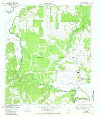
1982 Map of Yard
USGS Topo · Published 1982About this map
The Trinity River defines the western boundary of this 1982 survey, separating Anderson and Freestone Counties. The landscape is dominated by the extensive Coffield State Prison Farm, which encompasses thousands of acres of cleared fields, multiple ponds, and infrastructure including a Landing Strip, Athletic Field, and a Radio Tower. The river's winding course has left behind numerous oxbows and sloughs, such as Horseshoe Bend, Tyler Ferry Lake, and Alligator Slough, creating a complex riparian environment managed for water resources.
Find a feature on this map
45 named features on this map. Tap any name to fly to it.
Don’t see what you’re looking for? This feature index may not catch every label — zoom into the map to look around manually.
Map Details
Editions of this 1982 Yard Map
This is the sole edition of this map. No revisions or reprints were ever made.
Other maps of this area

1919 · Fairfield
USGS Topo · 1:62,500

1949 · Tennessee Colony
USGS Topo · 1:62,500

1950 · Tennessee Colony
USGS Topo · 1:62,500

1953 · Palestine
USGS Topo · 1:250,000

1954 · Waco
USGS Topo · 1:250,000

1955 · Waco
USGS Topo · 1:250,000

1957 · Palestine
USGS Topo · 1:250,000

1960 · Roustabout Camp
USGS Topo · 1:24,000

1961 · Young
USGS Topo · 1:24,000

1964 · Long Lake
USGS Topo · 1:24,000