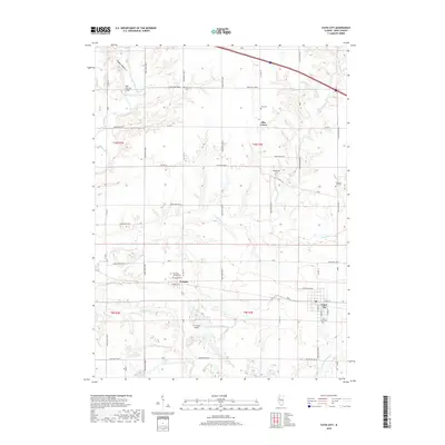
2018 Map of Yates City
USGS Topo · Published 2018About this map
Yates City serves as the primary hub on this Knox County landscape, where the local grid meets rural routes and the nearby Douglas settlement. The terrain is defined by the winding course of the Spoon River in the northwest, notable for the Wolf Covered Bridge, while numerous tributaries like French Cr and Hickory Cr carve through the agricultural fields. The map reveals a high density of small family and community burial grounds, including Elba Cem, Kightlinger Cem, and Pleasant Hill Cem, which provide significant data points for genealogists. The south-central portion features the Tri-County Airport and Grandt Lake, illustrating the more contemporary developments in transportation and land use within this classic Illinois prairie region. The rural character is punctuated by Elba Center, a crossroads that highlights the dispersed nature of local governance and social organization in the early 21st century.
Find a feature on this map
54 named features on this map. Tap any name to fly to it.
Don’t see what you’re looking for? This feature index may not catch every label — zoom into the map to look around manually.
Map Details
Editions of this 2018 Yates City Map
This is the sole edition of this map. No revisions or reprints were ever made.
Other maps of this area

1912 · Canton
USGS Topo · 1:62,500

1930 · Glasford
USGS Topo · 1:62,500

1941 · Maquon
USGS Topo · 1:62,500

1943 · Maquon
USGS Topo · 1:62,500

1944 · Elmwood
USGS Topo · 1:62,500

1948 · Elmwood
USGS Topo · 1:62,500

1948 · Glasford
USGS Topo · 1:62,500

1958 · Burlington
USGS Topo · 1:250,000

1958 · Peoria
USGS Topo · 1:250,000

1961 · Burlington
USGS Topo · 1:250,000