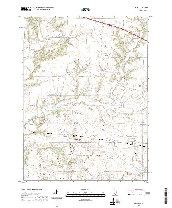
2024 Map of Yates City
USGS Topo · Published 2024About this map
Yates City anchors the southeast corner of this Knox County landscape, where the grid of W Main St and S Dixon St meets the rural agricultural expanse. The area's burial grounds are particularly well-documented for genealogists, ranging from the large Yates City Cem to smaller family or community plots like Catterton Cem and Kightlinger Cem. To the north, Elba Center and the Elba Cem mark the former hub of Elba Township near the upper reaches of French Creek. Drainage patterns throughout the quadrangle are defined by the Spoon River in the northwest and Hickory Creek further south, creating a dissected prairie landscape now largely utilized for farming and aviation at the Tri-County Airport. The map also preserves the small settlement of Douglas, situated along the intersection of 550 N and CO Hwy 19.
Find a feature on this map
51 named features on this map. Tap any name to fly to it.
Don’t see what you’re looking for? This feature index may not catch every label — zoom into the map to look around manually.
Map Details
Editions of this 2024 Yates City Map
This is the sole edition of this map. No revisions or reprints were ever made.
Other maps of this area

1912 · Canton
USGS Topo · 1:62,500

1930 · Glasford
USGS Topo · 1:62,500

1941 · Maquon
USGS Topo · 1:62,500

1943 · Maquon
USGS Topo · 1:62,500

1944 · Elmwood
USGS Topo · 1:62,500

1948 · Elmwood
USGS Topo · 1:62,500

1948 · Glasford
USGS Topo · 1:62,500

1958 · Burlington
USGS Topo · 1:250,000

1958 · Peoria
USGS Topo · 1:250,000

1961 · Burlington
USGS Topo · 1:250,000