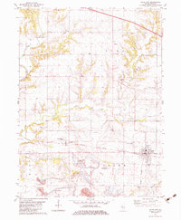
1982 Map of Yates City
USGS Topo · Published 1983About this map
Yates City serves as the primary population center in this Illinois landscape, situated at the junction of the Burlington Northern rail line. The surrounding rural townships of Elba and Salem are defined by a network of agricultural land and scattered homesteads, punctuated by family and community landmarks. The western edge of the quadrangle follows the winding course of the Spoon River, which is famously spanned by the Wolf Covered Bridge.
Find a feature on this map
33 named features on this map. Tap any name to fly to it.
Don’t see what you’re looking for? This feature index may not catch every label — zoom into the map to look around manually.
Map Details
Editions of this 1982 Yates City Map
This is the sole edition of this map. No revisions or reprints were ever made.
Other maps of this area

1912 · Canton
USGS Topo · 1:62,500

1930 · Glasford
USGS Topo · 1:62,500

1941 · Maquon
USGS Topo · 1:62,500

1943 · Maquon
USGS Topo · 1:62,500

1944 · Elmwood
USGS Topo · 1:62,500

1948 · Elmwood
USGS Topo · 1:62,500

1948 · Glasford
USGS Topo · 1:62,500

1958 · Burlington
USGS Topo · 1:250,000

1958 · Peoria
USGS Topo · 1:250,000

1961 · Burlington
USGS Topo · 1:250,000