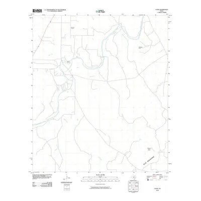
2010 Map of Yates
USGS Topo · Published 2010About this map
The Llano River meanders across this rural section of Kimble County, forming the central geographic spine for the small community of Yates. In the early 2010s, this landscape remained defined by its hydrology and ranching heritage, with a network of seasonal drainages including Salty Creek, Cedar Creek, and Sycamore Creek feeding the river valley. The terrain transitions toward the south into the Blue Mountains, while Edwards Draw marks the elevation changes in the northeast. Genealogists and local historians will find the Red Creek Cemetery located north of the river, a key landmark for tracing family roots in this sparsely populated region. Human infrastructure is limited to widely spaced ranch roads and the Robinson Ranch Airport, illustrating the secluded character of the Texas Hill Country at this time.
Find a feature on this map
11 named features on this map. Tap any name to fly to it.
Don’t see what you’re looking for? This feature index may not catch every label — zoom into the map to look around manually.
Map Details
Editions of this 2010 Yates Map
This is the sole edition of this map. No revisions or reprints were ever made.
Other maps of this area

1887 · Mason
USGS Topo · 1:125,000

1894 · Mason
USGS Topo · 1:125,000

1894 · Kerrville
USGS Topo · 1:125,000

1954 · Llano
USGS Topo · 1:250,000

1955 · Llano
USGS Topo · 1:250,000

1956 · Llano
USGS Topo · 1:250,000

1968 · Monument Mountain
USGS Topo · 1:24,000

1968 · Sheep Run Creek
USGS Topo · 1:24,000

1968 · London
USGS Topo · 1:24,000

1968 · Yates
USGS Topo · 1:24,000