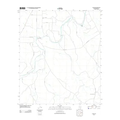
2012 Map of Yates
USGS Topo · Published 2012About this map
The Llano River winds through this section of the Texas Hill Country, defining the landscape of central Kimble County. Near a significant bend in the river, the small settlement of Yates serves as a local waypoint, connected by a network of ranch roads including Farm Road 3480 and Ranch Road 1871. This area is characterized by several significant drainages that feed into the Llano system, such as Red Cr, Salty Cr, and Cedar Cr.
Find a feature on this map
27 named features on this map. Tap any name to fly to it.
Don’t see what you’re looking for? This feature index may not catch every label — zoom into the map to look around manually.
Map Details
Editions of this 2012 Yates Map
This is the sole edition of this map. No revisions or reprints were ever made.
Other maps of this area

1887 · Mason
USGS Topo · 1:125,000

1894 · Mason
USGS Topo · 1:125,000

1894 · Kerrville
USGS Topo · 1:125,000

1954 · Llano
USGS Topo · 1:250,000

1955 · Llano
USGS Topo · 1:250,000

1956 · Llano
USGS Topo · 1:250,000

1968 · Monument Mountain
USGS Topo · 1:24,000

1968 · Sheep Run Creek
USGS Topo · 1:24,000

1968 · London
USGS Topo · 1:24,000

1968 · Yates
USGS Topo · 1:24,000