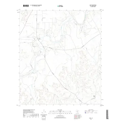
2019 Map of Yates
USGS Topo · Published 2019About this map
The Llano River snakes through the heart of this Kimble County landscape, defining the topography where several significant drainages converge. In the northwest corner, the small community of Yates sits near the junction of Red Cr and the river, served by a network of ranch roads and the crossing of Ranch Rd 385. This area retains its rural character, with the Red Creek Cem serving as a primary genealogical landmark for local family history research.
Find a feature on this map
26 named features on this map. Tap any name to fly to it.
Don’t see what you’re looking for? This feature index may not catch every label — zoom into the map to look around manually.
Map Details
Editions of this 2019 Yates Map
This is the sole edition of this map. No revisions or reprints were ever made.
Other maps of this area

1887 · Mason
USGS Topo · 1:125,000

1894 · Mason
USGS Topo · 1:125,000

1894 · Kerrville
USGS Topo · 1:125,000

1954 · Llano
USGS Topo · 1:250,000

1955 · Llano
USGS Topo · 1:250,000

1956 · Llano
USGS Topo · 1:250,000

1968 · Monument Mountain
USGS Topo · 1:24,000

1968 · Sheep Run Creek
USGS Topo · 1:24,000

1968 · London
USGS Topo · 1:24,000

1968 · Yates
USGS Topo · 1:24,000