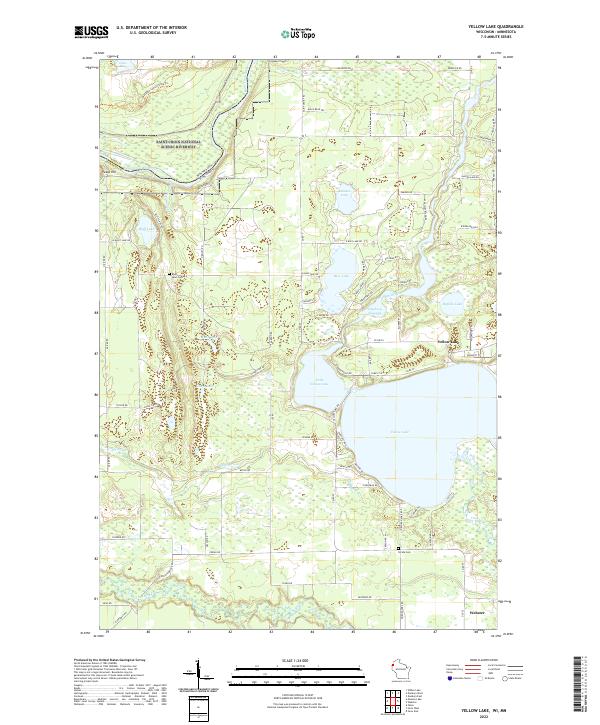
2022 Map of Yellow Lake
USGS Topo · Published 2022About this map
The Saint Croix National Scenic Riverway dominates the northwest corner of this map, following the winding path of the Saint Croix River along the border with Minnesota. This lake-rich region of Wisconsin's northern interior is defined by glacial waters and river basins, where the Yellow River feeds into the expansive Yellow Lake and the adjacent Little Yellow Lake. The landscape transition from riverine wetlands to higher ground is marked by features like Pease Hill and the Danbury Flowage. Genealogists and local historians can find family history markers at the Bluff Lake Cem and Perida Cem, while the road network—including Chase Fire Ln and Icehouse Bridge Rd—illustrates the rural character of the area surrounding Webster. The map captures a moment in the modern management of these wild waterways, documenting the preserved wilderness alongside established lakeside settlements.
Find a feature on this map
89 named features on this map. Tap any name to fly to it.
Don’t see what you’re looking for? This feature index may not catch every label — zoom into the map to look around manually.
Map Details
Editions of this 2022 Yellow Lake Map
This is the sole edition of this map. No revisions or reprints were ever made.
Other maps of this area

1949 · Danbury
USGS Topo · 1:48,000

1950 · Webster
USGS Topo · 1:48,000

1950 · Grantsburg
USGS Topo · 1:48,000

1953 · Duluth
USGS Topo · 1:250,000

1953 · Stillwater
USGS Topo · 1:250,000

1955 · Webster
USGS Topo · 1:62,500

1955 · Stillwater
USGS Topo · 1:250,000

1958 · Stillwater
USGS Topo · 1:250,000

1958 · Duluth
USGS Topo · 1:250,000

1962 · Cloverdale
USGS Topo · 1:62,500